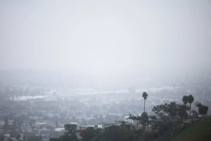
A powerful storm system known as an atmospheric river is making its way into California this week, bringing heavy rain and raising concerns about flooding and mudslides, especially in areas recently scorched by wildfires. Experts warn that the intense rainfall could trigger dangerous debris flows in vulnerable regions, particularly around Los Angeles.
So, what exactly is an atmospheric river? Imagine a massive conveyor belt of moisture stretching across the sky, transporting water vapor from tropical regions to cooler areas like California. These storms can dump huge amounts of rain and snow when they hit land, making them a key player in the state’s winter weather. One well-known type of atmospheric river is the “Pineapple Express,” which carries warm, wet air from near Hawaii straight to the West Coast.
California experiences several atmospheric rivers every winter, and they can be both a blessing and a curse. On the one hand, they provide much-needed rain and snow that help replenish water supplies. In fact, this storm is expected to add up to four feet of fresh snow to the Sierra Nevada, which will slowly melt and supply water throughout the year. But when these storms are too strong or hit too fast—especially in places recovering from wildfires—they can become dangerous.
Scientists have developed a ranking system to measure atmospheric rivers, similar to how hurricanes are classified. A weaker storm, ranked as a 1 or 2, is mostly beneficial, while stronger ones rated 4 or 5 can cause significant damage. The incoming storm is expected to be a 1 or 2 in Southern California, meaning it won’t be the most extreme—but it could still bring short bursts of heavy rain, which can be a major problem for burned areas where the soil can’t absorb water properly.
History has shown how deadly this combination can be. After the Thomas Fire in 2017-2018, a powerful atmospheric river slammed into Santa Barbara County, triggering catastrophic mudslides that killed over 20 people. Even though the total rainfall wasn’t record-breaking, brief periods of intense downpours caused hillsides to give way, sending torrents of mud and debris through neighborhoods.
With this latest storm, emergency officials and the National Weather Service are urging residents in fire-scarred regions to stay alert, watch for evacuation orders, and be prepared for possible landslides.
Scientists are also looking at whether climate change is making these storms more intense. While there’s no clear-cut link yet, many experts believe that as the planet warms, atmospheric rivers will carry even more moisture, leading to heavier rainfall and a higher risk of flooding. Warmer air holds more water, which means that when these storms hit the California coast and run into mountains, they can unleash even more precipitation than before.
Even though long-term data hasn’t confirmed a direct connection between climate change and the frequency of atmospheric rivers, some of California’s heaviest rainstorms in recent years suggest that these storms are becoming more extreme. If this trend continues, residents may need to prepare for stronger, wetter, and more unpredictable winter storms in the future.


