Winter storms can be full of surprises when it comes to the type of precipitation they bring. Sometimes it’s soft, fluffy snow covering everything in sight, while other times, it’s freezing rain, sleet, or even hail. But what determines what falls from the sky? It all comes down to temperature changes as the precipitation makes its way to the ground.
When the air is cold from the clouds all the way to the surface, we get snow. If it’s warm all the way down, we get rain. But things get a little more complicated when there’s a mix of warm and cold air in the atmosphere. That’s when sleet and freezing rain come into play—two winter troublemakers that are making headlines as an icy storm moves across parts of the central and eastern U.S.
So, what’s the difference between sleet and freezing rain? It all comes down to how much warm air the falling precipitation passes through.
Sleet starts as snow high up in the clouds. As it falls, it briefly melts into rain when it hits a small layer of warm air, but then it quickly refreezes into tiny ice pellets before reaching the ground. These ice pellets bounce when they land and can add a crunchy layer to roads and sidewalks.
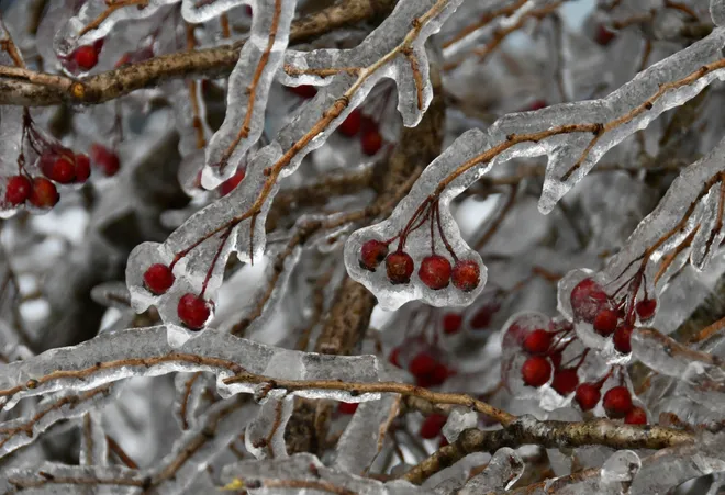
Freezing rain, on the other hand, takes a different journey. It also begins as snow, but this time, it passes through a thicker layer of warm air, completely melting into rain before hitting the ground. The problem? Instead of refreezing mid-air like sleet, it stays liquid until it reaches the freezing surface, where it instantly turns into a layer of ice. That’s why freezing rain is so dangerous—it creates a slick, glassy coating on roads, trees, and power lines, making travel extremely hazardous.
Meteorologists say freezing rain is far worse than sleet when it comes to dangerous conditions. While sleet might sound scary since it involves ice pellets, it actually provides a little bit of traction for cars. Freezing rain, however, turns everything into an ice rink, making walking and driving treacherous.
And what about hail? While it’s also a type of frozen precipitation, it forms in a completely different way. Hail is a warm-weather phenomenon that develops inside powerful thunderstorms, not winter storms. At the top of a thunderstorm, where the air is freezing, tiny ice particles start forming. As they swirl around in the storm, strong updrafts push them higher, allowing more ice to build up. This process continues until the hailstones get too heavy, and gravity sends them crashing to the ground.
Unlike sleet, which is usually tiny, hail can grow to impressive sizes. Most hailstones are small, like the size of a penny, but some can be massive. In fact, the heaviest hailstone ever recorded weighed over two pounds and fell in Bangladesh in 1986!
So, the next time you see winter precipitation in the forecast, you’ll know exactly why it’s happening—and whether you should expect soft snowflakes, bouncing ice pellets, or a dangerous, icy glaze.


